A biodiversity hotspot is a conservation framework for identifying terrestrial regions that combine extraordinary Biodiversity and high Endemism with severe historical habitat loss. The concept was introduced by Norman Myers and subsequently adopted and refined by Conservation International and partners for global priority setting in conservation planning (journal://Nature|Biodiversity hotspots for conservation priorities|2000). According to programmatic definitions used today, 36 such regions are recognized worldwide. Conservation International and the Critical Ecosystem Partnership Fund specify two qualifying thresholds: at least 1,500 endemic vascular plant species, and a reduction of original native vegetation by 70% or more. (
cepf.net)
Definition and criteria
- –A biodiversity hotspot is defined by two quantitative criteria that emphasize both irreplaceability and threat. First, a region must contain at least 1,500 species of vascular plants found nowhere else. Second, it must have lost at least 70% of its original native vegetation (framed as “30% or less of original natural vegetation remains” by Conservation International). These thresholds were formalized to focus scarce resources on places where conservation gains are likely to avert the greatest number of extinctions. See
CEPF and
Conservation International. (
Origins and development
- –Myers’ early essays (1988, 1990) culminated in a widely cited 2000 Nature article identifying 25 hotspots based on exceptional endemism and extreme habitat loss (journal://Nature|Biodiversity hotspots for conservation priorities|2000). Conservation International’s first synthesis volume extended the approach to 25 regions in book form, followed by an expanded analysis in the illustrated reference Hotspots Revisited (book://Russell A. Mittermeier et al.|Hotspots Revisited: Earth's Biologically Richest and Most Endangered Terrestrial Ecoregions|Conservation International|2004). Subsequent reassessments recognized additional regions, bringing the total to 36; recent additions include the Forests of East Australia (2011) and the North American Coastal Plain (2016), as documented by
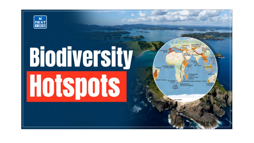
Extent and global significance
- –Collectively, intact habitats within hotspots cover roughly 2.5% of Earth’s land surface yet shelter more than half of the world’s plant species as endemics and nearly 43% of endemic birds, mammals, reptiles, and amphibians, underscoring their disproportionate importance for species persistence. These figures are reported by
National Geographic. Note that the widely quoted “~2–3% of land” refers to remaining natural habitat inside hotspot boundaries, not their original extent, as clarified by comparative analyses in the scientific literature. (
Examples of hotspots
- –Tropical Andes: Among the most species-rich hotspots, with on the order of 30,000 vascular plants and very high endemism; it leads hotspots for plant diversity. See
- –Madagascar and the Indian Ocean Islands: Madagascar alone supports roughly 11,200 endemic plant species and multiple vertebrate families found nowhere else, illustrating long-term isolation and diversification. See
- –Additional well-known hotspots include Sundaland, the Mediterranean Basin, Indo-Burma, the California Floristic Province, the Cerrado, and Wallacea; the majority occur in the tropics, though notable temperate examples exist. Overviews and current lists are maintained by
Use in conservation practice
- –Hotspots guide philanthropic and public investments through partners such as the Critical Ecosystem Partnership Fund, which provides grants to civil-society organizations in hotspot countries. The approach complements site-based tools like Key Biodiversity Areas (KBAs), a standardized method led by IUCN to identify sites contributing significantly to the global persistence of biodiversity. See the KBA global standard (document://IUCN|A global standard for the identification of Key Biodiversity Areas: version 1.0|2016) and IUCN’s overview page. Hotspot maps are also referenced in policy dialogues related to the Kunming–Montreal Global Biodiversity Framework’s Target 3 (“30x30”) under the Convention on Biological Diversity, which emphasizes conserving areas of particular importance for biodiversity. See the official CBD summary of the framework’s targets.
IUCN;
CBD. (
Relationship to other global prioritization frameworks
- –Hotspots are one of several complementary approaches. The WWF-led Global 200 identifies 238 terrestrial, freshwater, and marine ecoregions of exceptional biodiversity and ecological representation, emphasizing ecosystem-level coverage rather than endemic-rich, highly threatened regions alone. See
WWF Global 200 and Olson & Dinerstein (2002). Hotspots, by contrast, are terrestrial and threshold-based on plant endemism plus habitat loss; they frequently overlap with—but are not equivalent to—Global 200 ecoregions or KBA networks. (
Critiques and limitations
- –Scientific assessment has noted that hotspots defined by plant endemism and habitat loss do not always coincide with areas of peak richness, threat, or irreplaceability for all taxa, and cross-taxon “hotspot” congruence can be low. For example, a global analysis of non-marine mammals found that hotspots of richness, endemism, and threat were often noncongruent, cautioning against single-metric prioritization. See Schipper et al. and related analyses in the peer-reviewed literature.
PNAS. Public-facing discussions have also highlighted debates over whether a hotspot focus sufficiently captures ecosystem function and services, or risks neglecting large, relatively intact “wilderness” areas with lower endemism. See
Scientific American. (
Governance and mapping
- –Hotspots are not formal protected-area designations and carry no direct legal status; rather, they serve as planning units that frequently encompass many protected and conserved areas within their boundaries. Definitions and management implications are summarized by the Biodiversity A–Z resource maintained by UNEP-WCMC.
Biodiversity A–Z. Because threats, species knowledge, and land cover change over time, hotspot boundaries and profiles have been revised in successive syntheses and datasets (e.g., 2016 UNEP-WCMC dataset; CI/CEPF updates). (
Internal cross-references: Biodiversity; Norman Myers; Conservation International; Endemism; IUCN; Key Biodiversity Areas; WWF.