Geomagnetism is the study of Earth’s magnetic field, including its origin, spatial structure, temporal variability, and practical applications in navigation, geologic mapping, and space-weather monitoring. More than 90% of the observed field at the surface is generated inside Earth’s fluid outer core, with additional contributions from magnetized crustal rocks and from electrical currents in the ionosphere and magnetosphere. Units are typically expressed in nanotesla (nT). Typical surface intensities range from about 32,000 nT at the magnetic equator to about 62,000 nT at polar regions (NOAA SWPC;
Britannica). (
swpc.noaa.gov)
Origins and sources
- –Core field (geodynamo): The primary, slowly varying “main field” is maintained by convection of electrically conducting liquid iron alloy in the outer core, twisted by planetary rotation—a process described by dynamo theory and reproduced in 3‑D magnetohydrodynamic simulations (
NASA Science;
Glatzmaier & Roberts, 1995 abstract). (
- –Crustal field: Magnetized rocks in the crust generate local to regional anomalies that are mapped globally by products such as EMAG2 and high-resolution lithospheric models (e.g., LCS‑1) (
NCEI EMAG2;
Britannica). (
- –External fields: Electric currents in the ionosphere and magnetosphere produce short-term variations, including the solar quiet (Sq) current system and auroral electrojets; these are central to space-weather indices and forecasting (
GSFC Sq model;
NOAA SWPC). (
Structure and variability
- –Dipole and non‑dipole components: To first order the field resembles a tilted dipole, but significant non‑dipole structure evolves over time (“secular variation”), with features that often drift westward and contribute most of the short‑century changes (
- –Pole motion: The magnetic dip poles (where field is vertical) wander substantially. Modelled positions and surveys indicate rapid recent motion of the North Magnetic Pole, with WMM‑based estimates placing it near 85.762° N, 139.298° E in 2025 (
- –South Atlantic Anomaly (SAA): A long‑lived region of depressed field strength over South America and the South Atlantic affects satellite operations; observations show the SAA has split into two minima and continues evolving through 2025 (
NASA SVS;
ESA Swarm). (
Observation and measurement
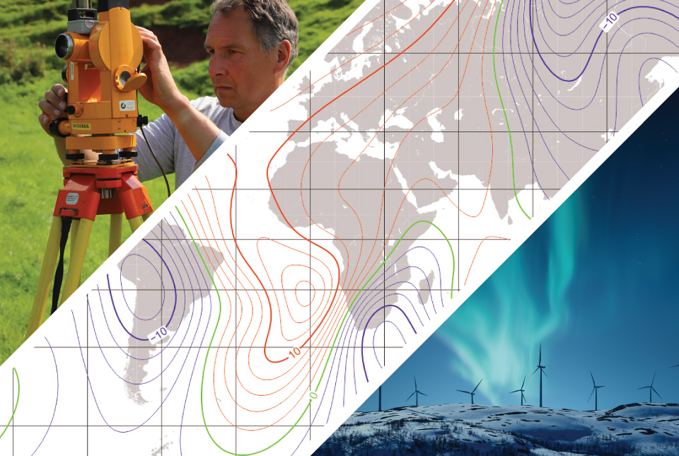
- –Components and elements: Magnetic induction B at Earth’s surface is described by Cartesian components X (north), Y (east), Z (down), horizontal intensity H, total intensity F, declination D, and inclination I; these are standard outputs from global field models (
- –Ground observatories: Dense ground networks provide continuous monitoring for science and hazard mitigation; in the United States, the USGS operates 14 magnetic observatories distributed from Alaska to Puerto Rico (
USGS Geomagnetism Program). (
- –Satellite missions: Modern field models rely on satellite magnetometry (e.g., Ørsted, CHAMP, and ESA’s three‑satellite [Swarm (satellite constellation)]). Swarm, launched 22 November 2013, resolves core, lithospheric, oceanic, ionospheric, and magnetospheric contributions (
GFZ CHAMP). (
Models and indices
- –Global models: Two widely used spherical-harmonic models represent the main field and its change. The World Magnetic Model is updated every five years for navigation; WMM2025 was released on 17 December 2024 and is valid through 2029.0 (
IAGA;
BGS IGRF‑14). High‑resolution research models (e.g., CHAOS‑8, LCS‑1) incorporate Swarm/CHAMP data to better resolve lithospheric and time‑varying fields (
DTU models). (
- –Activity indices: Geomagnetic activity is summarized by indices such as Kp (planetary K, quasi‑logarithmic 0–9 from mid‑latitude stations), Ap (linearized), Dst (hourly depression from the ring current at low latitudes), and AE (auroral electrojet strength). Kp underpins NOAA’s G‑scale storm alerts (
NCEI Dst). AE and its AU/AL components are produced by Kyoto WDC to monitor auroral electrojets (
Kyoto AE). (
Space weather and aurora
- –Coupling with the solar wind and the Magnetosphere produces geomagnetic storms, substorms, and associated ionospheric disturbances. Southward interplanetary magnetic field and CME/HSS drivers amplify magnetospheric currents, alter radiation belts, and enhance auroral activity. Operationally, NOAA’s Space Weather Prediction Center issues watches and warnings tied to Kp/G‑scale thresholds (
NOAA media advisory). Auroras manifest where accelerated magnetospheric electrons precipitate along field lines into the upper atmosphere (
Applications
- –Navigation and orientation: Magnetic declination from WMM is embedded in aircraft, maritime, defense, and consumer systems (e.g., smartphones) to provide heading information complementary to GNSS, especially when GNSS is degraded or unavailable (
EMAG2). (
- –Hazard mitigation: Magnetic storms induce geoelectric fields that can drive geomagnetically induced currents (GIC) in power grids and pipelines; USGS hazard analyses identify elevated risks in resistive geological regions of the U.S. (
USGS Fact Sheet 2024‑3036;
History and institutions
- –In the 1830s, Carl Friedrich Gauss and Wilhelm Weber founded the Göttingen Magnetic Union, developed absolute measurement methods and magnetometers, and published spherical‑harmonic analyses showing that most of the field originates within Earth; Alexander von Humboldt catalyzed a global observatory network. The International Association of Geomagnetism and Aeronomy (IAGA) now coordinates standards such as the IGRF and community data products (
HGSS history;
Deep time and Paleomagnetism
- –Thermoremanent magnetization in rocks and sediments records past field directions and intensities, enabling reconstruction of plate motions and the chronology of geomagnetic reversals. Reversals are irregular in time, with durations of transition typically thousands of years, and remain an active research topic in dynamo theory and paleomagnetic observation (
Reviews of Geophysics—Valet & Fournier, 2016). (
Key organizations, datasets, and missions include International Association of Geomagnetism and Aeronomy (IAGA) and its IGRF, World Magnetic Model (NOAA NCEI/BGS), the NOAA Space Weather Prediction Center, the USGS Geomagnetism Program, and satellite missions such as Ørsted, CHAMP, and [Swarm (satellite constellation)] that underpin modern field models and space‑weather services (IAGA;
NCEI WMM;
USGS;
ESA Swarm). (
iaga-aiga.org)
Internal links used: Earth's magnetic field, Dynamo theory, Magnetosphere, International Association of Geomagnetism and Aeronomy, World Magnetic Model, International Geomagnetic Reference Field, Paleomagnetism, [Swarm (satellite constellation)], Aurora.